What is a Topographic Survey?
A UAV capture, overlaid with a topographical survey
What is a Topographic Survey?
A Topographical Survey, sometimes referred to as a Land Survey, is the process required to produce an accurate and detailed map identifying both the natural and man-made feature within an area. The collected data may be presented in many formats, these are generally PDF for printing and CAD for construction professionals.
Why is a Topographic Survey required?
Without having an accurate plan showing the exiting features, size and topography of a site a designer has no form of reference in terms of how the proposed works will sit on the site, how much excavation or fill is required, which ways the drains will fall etc. Similarly, if the design has no topographic background to show the existing features, how can the local authority consider how it will impact the local area visually and environmentally? When the contractor comes to build the design, without the topographic survey to show where it sits on the site and how the levels relate to the site he won’t know where to build it.
The existing detail shown on a topographic survey may be required for either record or planning purposes. Other information, such as areas and volumes, may be calculated from a survey. Purposes to which a topographical Survey may be used include:
· Housing or commercial redevelopment design layout
· Infrastructure design
· Boundary, Easement, Rights of Way and Land Registry
· Location of neighbouring property details and boundaries.
· Locating specific items of detail
· Showing the existing layout of surface features
· Development or alterations to land use
· Location of trees and tree canopies, on or off the site
· Modelling and visualization of the ground in 3D
· Historical and pre-construction records.
It is worth bearing in mind that a survey prepared for one purpose is not necessarily going to be of sufficient accuracy or detail to be used for another. A thorough survey reduces the possibility of making costly mistakes at a later stage if unforeseen problems are uncovered.
If a design is based upon an inaccurate or incomplete topographic survey the consequences can be severe. In some cases the contractor will have to stop work, additional topographic survey data will be required, the design will require alteration, planning permission may require re-submission, the contractor will have to re-price the altered design work. Every one of these has a cost and time implication which will affect the project.
Equipment used
The choice of equipment is often best left to the surveyor. Kemp employ the latest technology and instruments including GPS, 3d laser scanners, total stations, UAV drones. These are all tools that we can employ to obtain the optimum solution to your survey requirements. Data is invariably digitally logged and downloaded directly for computer processing.
Factors effecting a Topographic Survey
Topographical Surveys are defined by five main criteria:
1. The area to be surveyed.
2. The detail required.
3. The accuracy required.
4. The grid and datum the survey is to be related to.
5. How the data is to be presented.
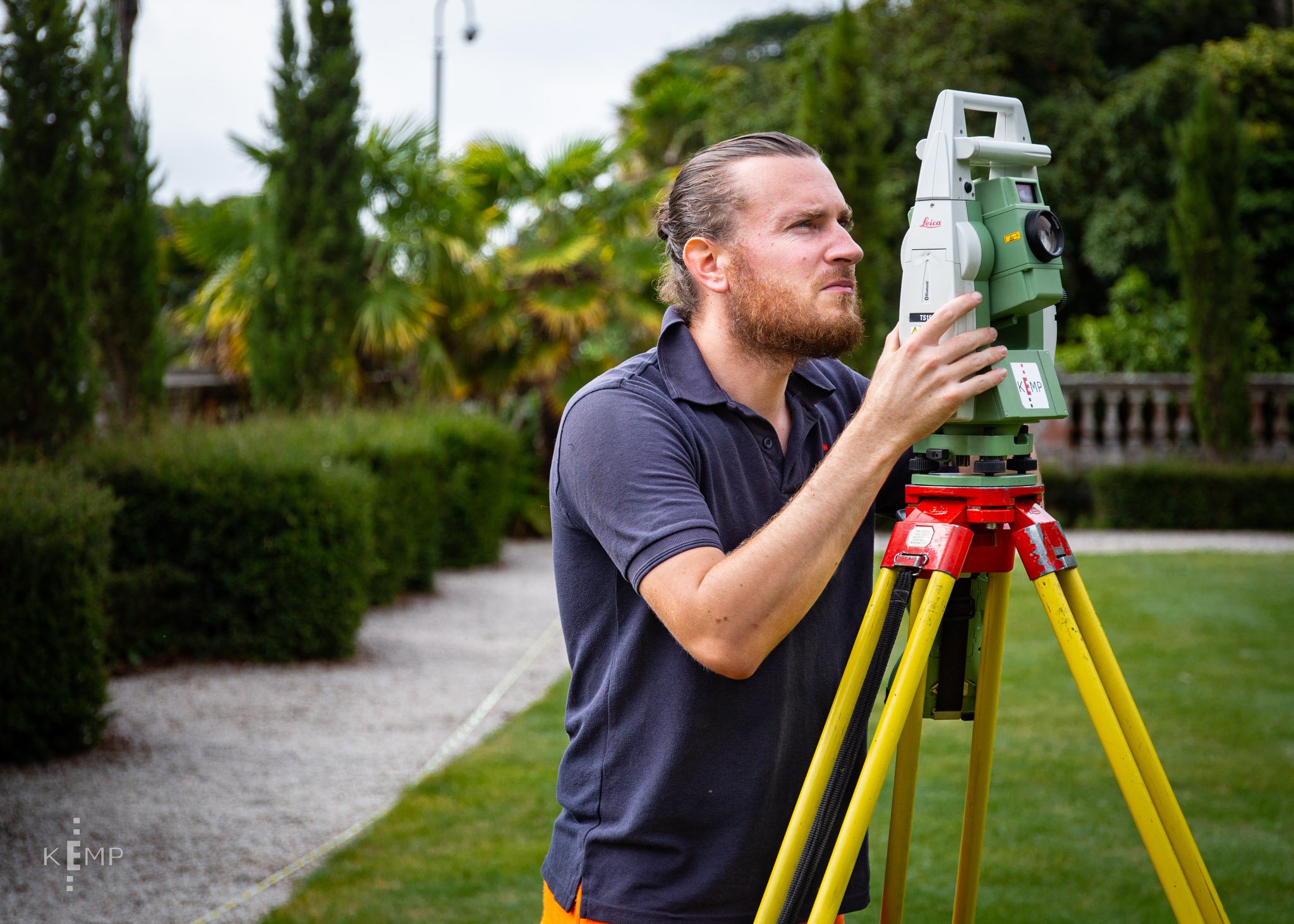
A Leica total station
The area to be surveyed
You may require detail beyond the boundary of your site. Think about the road in front of the site, the requirement for visibility splays to be designed and the location of existing features that may affect the project. There may be issues of access that have to be considered. Kemp have numerous techniques which may make it possible accurate data without going onto neighbouring land. When specifying the survey area it is important to provide an accurate plan that clearly identifies the area to be surveyed. We have a video in our client guide section which may assist you to draw one up.
The detail required
The amount of information that needs to be recorded will affect the time the survey takes and therefore the cost of the survey. It is therefore important to carefully consider the information required when specifying a survey. Avoid specifying ground levels at close intervals, the surveyor will pick up changes in grade, and a 10m to 20m grid is generally ample to define the topography. A consistent grade like a football pitch needs far less spot levels than an undulating site. If you think that a level grid of 5m spacing has 84% more points than one that has a 20m spacing there is little wonder that it is more expensive to survey.
The amount of detail and how it is shown is usually related to the scale. For example at 1:100 a manhole 0.6m wide on the ground will be 6mm wide on the paper and may be individually measured and plotted to scale whereas at 1:500 the same manhole will only occupy 1mm on the paper and a generic symbol could be used. As a general rule, items that occupy less than 1mm or 2mm on the paper, such as lamp posts and stop valves are represented by symbols. Scale will also limit the level of detail shown on items such as walls. For example at 1:100 scale a 0.22m brick wall will be shown as a double line (both sides) and a brick pier 0.45m on the end could be detailed. Whereas at 1:500 the same wall would be a single line and the brick pier, (less than 1mm on the
paper), could be ignored. At Kemp all of our surveys are carried out at 1:200 unless requested otherwise. In this digital CAD era this has proven to be the optimum scale for most surveys and covers and walls are shown more in line with a 1:100 survey and there are less symbols applied.
The accuracy required
Computer aided drawing (CAD) can determine the exact distance between any two points, however all measurements will have a tolerance. In a topographical survey accuracy is related to scale e.g. a 1:100 based survey will be more accurate than a 1:200 or 1:500 scale survey.
The RICS specification for Surveys of Land, Buildings and Utility Services at Scales of 1:500 and Larger states that: “The accuracy of planimetric detail shall be such that the plan position of any well-defined point of detail shall be correct to within 0.3mm r.m.s.e. at the plan scale when checked from the nearest permanent control station.” Therefore, using this specification, a point of detail on a 1:100 survey would be accurate to 30mm r.m.s.e and on a 1:500 survey would be accurate to 150mm r.m.s.e when checked from the nearest permanent control station.
Grid and Datum
More often than not small to medium surveys have traditionally been undertaken to a local grid and aligned approximately to north. Advances in technology and GPS enables surveys to be quite easily related to OS National Grid these days and Ordnance Survey no longer support the ground-based benchmarks or trig pillars. At Kemp all of our topographic surveys are related to OS National Grid and datum and generally with a scale factor of 1 applied. Scale factor occurs as a result of the Ordnance Survey allowing for the curvature of the earth in its grid system. At Kemp we apply scale factor when appropriate, which is usually on large scale infra-structure projects and our survey reports and drawing titles explain the factors applied. This is critical information that is required by the setting out engineers during construction and hence designers should not replace the surveyors drawings titles and borders with their own as this critical information is often lost which can cause issues during construction. Our surveys will establish control datums on site for the construction teams and for easy reference for planners.
A processed topographical survey
Survey results and presentation
Kemp surveys are typically presented as 2d CAD files that contain 3d hidden triangles that can be employed by professionals that require ground modelling. A 2d CAD drawing still includes contours and ground levels. 3d CAD drawings can also be provided if required. A bordered PDF is supplied to enable plotting onto paper. Presentation and results can be tailored to the clients requirements with layering systems and the like altered, by default, different features will be provided with an appropriate layer name in CAD.
Considerations when tendering
Kemp Chartered Land and Engineering Surveyors have methodologies and experience that can achieve greater accuracy and efficiencies than many of our competitors. It’s important to discuss your requirements at an early stage to determine the best way forward. It is very easy to over specify the level of detail, density of points and the precision of the points. We can advise the most appropriate and cost effective way to meet your requirements and add value to your survey data.
Specifications are often generic, and organisations and individuals give little thought as to what they require and can even conflict with what is required. At Kemp, as a Chartered Land Survey firm that is regulated by RICS we employ the RICS Specifications for Measured Surveys of Land, Buildings and Utilities as our default. We like to work in partnership with our clients and believe that if we know the requirements for the survey and what it will be used for, they will then be able to advise
on the appropriate specification and accuracy for the work.
What if I need to obtain competitive quotations?
Prepare an approved short list of established Chartered land survey firms.
Draw up a brief to include:
· Purpose of the survey
· Plan with survey area outlined
· Specification including any special requests
· Deliverable digital data format and hard copy if required
· Programme including phased delivery on large projects
· Site access and security arrangements.
Please don’t be afraid to consult with us for some experienced, professional and friendly advice.
Conclusions
· A topographic survey is the foundation of your project.
· Consult with our professional team openly, advise us what the survey is to be employed for.
· Our dedicated team of professionals will assist in optimising accuracy, detail and cost.
· Our experienced surveyors will ensure that plans are future proofed to enable easy extension in line with design developments.
· Our quality survey team provide project lifetime support through planning, design, construction and maintenance.
Capturing data of a coastal building with a 3D scanner


